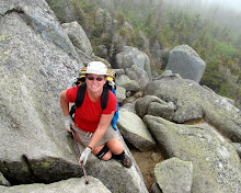
Saturday, March 11, 2006

Green Swamp East

This is an impromptu day hike, and I'm joined by frind Deb who is staying a couple of days. She's not usually a hiker, but has agreed to come out for a short walk, so I Looked up the closest trail section of about 10 miles with a parking lot at each end. We shuttled a car to the SR471 parking lot and set out from the Green Swamp East trailhead.

The trail was a mixture of Cypress swamp, oak and pine forest, and crossed the Withlacoochee river several times. There were several sections of forest road walks. The weather was clear with a light breeze, and temps in the 80's. A couple of places were a little too sun exposed in the middle of the day, but for the most part the trail was nicely shaded.

After abot 3 miles we came across some trail signage where a loop trail joined the main trail. It listed the mileage for the thru trail as 10.8 miles. Exactly whatI had planned for the day, except we'd already walked almost 3 - ooops! We discussed just taking the loop trail then doubling back to the car, but Deb decided she was up to the full, now 14 mile hike, so we continued on, but just agreed to slow the pace a little and take a couple of nice long breaks in the shade as the heat increased.

We passed through several areas that had recently burned, but the new green regrowth of grass and Palmetto shows how quickly the forest begins to recover. We ended up taking several short water and snack breaks and two long lay down - shoes off breaks, including an hour long lunch and nap break. We ran short of water in the afternoon, so stopped at a flowing creek to collect and treat water. I actually managed to catch a small fish in my water bottle. I can't even imagine I'd have been able to do that if I'd been trying to catch a fish! We rescued him from the bottle before adding the iodine. I don't think Deb fancied having him swimming around in her water bottle anyway!

Late in the afternoon we crossed the Withlacoochee River once again at a road bridge. The worst of the day's heat had already passed, but the water still looked cool and inviting. We investigated the river bottom and found it was cool soft moss and firm sand, with no slimy mud. We could not resist the opportunity to strip down and enjoy a refreshing soak. We both wished we had been here for our lunchtime nap, but it was a great rest stop any time of day.
At the end of the day, after a wonderful day's hiking, albeit about 4 miles longer than expected, we reached the road, and the southbound register. We flipped open the lid, and found squatters have moved themselves into this nice cosy steel home!

View more photos in my Picasa album

Saturday, March 4, 2006

Hog Island

So my idea of a contiguous NOBO section hike obviously isn’t going to work. Having completed the first 7 or so miles of Big Cypress, the next section is a 3 day backpack trip with no accessible roads to split it up. I could take the time off an do it over a long weekend, but I can’t find anyone to go with me. The Rangers at Big Cypress are strongly advising against going solo. So to continue with my Florida Trail section hike I’ve picked out a couple of day/weekend segments close to home. I’ll just have to wait to finish Big Cypress. This weekend I’m hiking again with Mindy, who came on the Loop Road hike.

We started out the day at Hog Island campground, where we secured a camp site for the night, and left one vehicle, then drove to At River Junction where we left the second vehicle. After a brief false start we realized we had not actually seen an orange blaze since we left the car, and we doubled back and took the correct left turn (the one on the left!), actually headed down the correct sand road to River Junction and the start of the Croom Trail.

From the trailhead the trail skirts several small Cypress swamps. We really enjoyed the clear still water, with the sunshine flooding through the new spring green of the trees. Eventually the trail wound its way to the Withlacoochee River, back to the swamps, and then oak forest.

We saw plenty of wildlife throughout the day, from deer in the campgrounds, to birds, butterflies, a very fast black snake, and the little turtle. The butterfly would only allow me within a couple of feet, then would fly about 20 feet down the trail, let me within a couple of feet and fly 20 feet further. This went on for long enough that we thought it was hiking the trail with us! Eventually he flew off into the forest without us.

The last 1/4 mile of or so of the trail was through a pine forest, and we were home at our campsite for the night, complete with a campfire and steak dinner.

View more photos in my Picasa album

Saturday, February 11, 2006

Southern Arizona Trip

First stop for the trip was at Watson Hot Well just outside Thatcher, AZ. The well is on BLM land with free camping. The tub was empty when I arrived late afternoon, but soon filled with nice warm water. It was a cloudy day, and I had travelled through some cold drizzly rain earlier in the day, but the sky cleared off around sunset.

Chiricahua National Monument
Chiricahua is an area of volcanic rock that was uplifted causing vertical colmnar fragmentation. Erosion of the softer layers has caused unique reshaping of the columns. Some of the columns have eroded to the extent that big rock is left balancing on the top of the column, and some of the erosion gives the impression of facial or animal features. The raised rock area is known as a "Sky Island". There is no water around to make it a true island, but is sits out as a standalone mountain in the sea of surrounding desert. At a couple of places on the Heart of Rocks trail the surrounding desert was a vivid yellow and red flat contrast to the rocks and blue sky.

At the end of the day's hiking I wandered around Masai Point in the very windy cold for the sunset. It was so cold that the batteries in my camera registered as dead, a new set lasted only a couple of photos before also showing as empty. I was judicious with the camera, keeping it warm inside my jacket between photos and managed to squeeze off a few last shots.

Saguaro National Park is a Sonoran Desert landscape dominated by the uniquely recognizable Saguaro cactus.

Picacho
Final stop for this trip is a Hohokam petroglyph site not far from Picacho Peak State Park. The Petroglyphs are scattered over a large heap of boulders which involved scrambling around and over the rocks to get to the pictures. It was a very pleasant afternoon, and after climbing around a while I just found a comfortable rock to plant myself on and enjoy the late afternoon sunshine.

After enjoying the sunshine for a while I packed up the car and drove back to Phoenix, with one last stop for a picture of the moonrise over the Saguaros.

View photos in my Picasa album

Sunday, January 29, 2006

Starting at the Beginning

I started off with this idea that I wanted to hike the entire trail, albeit in sections, contiguously from South to North. However, the trail starts with one of the most remote sections, Big Cypress National Preserve. I had read in the Florida Trail literature, and other trip journals that the lower swamp sections are strenuous, and should not be attempted alone. The water level in the swamp is currently quite high from Hurricane Wilma’s passage over south Florida late last fall. As luck would have it, I stumbled across a group that annually hikes the Loop Rd to Oasis Visitor Center segment. I contacted them and they agreed to let me join them. At the last minute, Mindi, a recent acquaintance from an online Women's hiking group decided to join me too. We drove down to the meeting point at the Oasis Visitor center in the middle of the night. The highlight of our drive was on SR 29, shortly after exiting Interstate 75. Passing through the Florida Panther refuge area, we saw a panther on the side of the highway. An exciting first for both of us. It would have been nice if I had had the presence of mind to stop or double back to attempt a photo!

We arrived at Oasis visitor center at around 5:30am and settled down for a power nap. I managed an hour or so of sleep before birdsong and the sounds of the occupant of a nearby vehicle woke me. We boiled some water for coffee and oatmeal breakfast, then stopped by the gator pond to enjoy our morning coffee before the group assembled at 8:30ish.

At 9am we stopped by the visitor center, arranged for the permit, checked with the Ranger for current trail conditions, and watched the 15 minute video about the ecology of the Preserve. The Ranger advised that the trail was rough, and mostly under mud and likely knee high water. He warned about the large numbers of Cottonmouth snakes, but thought we should get through OK. We shuttled in one van about 13 miles by road to the trailhead where we were joined by the remainder of the group. We saw 3 gators and a deer on the lime road, the only wildlife we saw all day. In all there were eleven in the hiking group, Mindi and myself being the only women.

It was around 10:30 when we set off on the trail. The weather was great for hiking, warm enough to be comfortable with a minimum of clothes, but not hot, and with a gentle breeze. The cypress trees have no foliage at this time of year, and the bromeliads and other plants have just started to flower. The predominant colors are silver grey, with a lightly overcast blue sky. The trail for most of its length is potholed limestone base covered by varying depths of dark, slippery mud and puddles.

Within 20 feet the trail is muddy, and wet, and water was already over the tops of my shoes giving me wet feet. A previous swamp backpack trip 2 weeks ago had left me with large blisters on my left heel and toe. Neither were bothering me now, but I was a little concerned that with the immediate wet that I may be in for a recurrence of either, both, or more.

The three first mile of the hike is through a cypress grove and grassy prairie. There is little shade, and the sky cleared somewhat in the warmest part of the day, but was still pleasant. We saw bobcat and raccoon tracks, a variety of birds, signs of deer remains (presumably some cat's feast), and cypress trees that were obviously "cat scratch" posts, but no other wildlife. We intended to stop for lunch at Frog Hammock Camp (a "hammock" is a slightly elevated and therefore often drier island in the swamp) but it was already occupied when we arrived, so we continued on.

The trail at this 3 - 4 mile section becomes much more swamplike. Elevation changes of only a few feet make swampy pools of slowly moving water among slightly raised areas of brush, vines, ferns, and other undergrowth. There is much more green and brown. A compost like base to the trail means less mud and limestone directly underfoot, but to get to these raised areas the trail passes through the swamp pools. The water here covers the same several inches of mud over limestone, and was mainly around knee high. The water was clear for those lucky enough to traverse first. For those in the rear the slowly swirling mud obscured the potholes, cypress knees, fallen logs, roots, etc. A hiking pole is definitely an advantage here for probing ahead to gauge footing and depth, and for stability when a pothole, root, knee, stump, other unseen hazard, or just plain old mud causes imbalance. On the raised hammocks the water is no longer an issue, but the dense undergrowth means bushwhacking though vines, palmetto scrub, under and over fallen trees, limbs, etc.

This mile or so of trail has been heavily affected by Hurricane Wilma last fall. Many of the trees that have the trail marking orange blazes have fallen. Many more trees are down across the trail, and the undergrowth is thick and thorn covered. We frequently could not see the next orange marker and could not discern which direction the trail continued. At these places several of the front hikers would fan out looking for blazed trees, while the remainder waited back at the last known blaze. When someone discovered the next marker we would all attempt to follow their course, and seek out the next blaze.

It was only a fairly short stretch where this was a concern, but bushwacking hiking like this is tedious and time consuming. We had not yet even had lunch, and for a short period there was some discussion of maybe retracing our steps to return back the way we had come. Eventually though, we stumbled our way from blaze to blaze and somewhere around mile 4 got back to a fairly straight, though submerged trail that could be easily followed. Here, in a slightly raised area with not too much brush we stopped for lunch. There was no real dry ground. Some settled on a log or stump, but most (including me) just stood to eat.

The trail here turned to a channel of knee high water over the mud, limestone potholes, cypress roots and knees. There was little underbrush allowing a faster, though splashier pace. As we set off, someone noticed that we had shared our lunch spot with a snake. I was already several yards down the trail, and did not go back to see it, but those that did said it was a Cottonmouth. It was less than 2 feet from where one of the party had just rested for 20 minutes eating lunch, and not one of us had seen it!

The submerged trail continued as this slosh through muddy water. The mud underfoot was ever present, with the potholes, cypress knees, logs, etc., providing frequent obstacles. One step the water may be only 6 inches deep, the next maybe up to the knees. After about 1/2 mile the land elevated slightly and the terrain turned back to the cypress prairie that we had encountered for the first several miles. Most of the deep water disappeared, but the mud here was deeper than the start of the hike. Maybe it was just perception as now my legs were getting tired, and my shoes were now filled with and encased in several pounds of mud, but the mud seemed slippier too. The deepest, slippiest sections caused a vacuum to be created within my shoes at each step. This meant curling my toes to release the inner shoe vacuum. My feet were already kind of busy trying to move forward, stay gripped on the trail, lift pounds of slimy mud, avoid potholes, and attempt to keep my legs and body in a vertical position. Now I was asking them to curl up to de-suction too. They weren't very happy with me! Once again I was grateful for the hiking pole, which prevented me falling several times.

During this muddy mile, while concentrating almost exclusively on where feet were being placed we came across two more Cottonmouths lying right next to the trail. Seeing three in such a short distance made me wonder how many we hadn't seen!

The final mile or so of trail was less prairie and more Cypress trees. The trail was still as muddy, and the trudging through it slow. Finally, at the 7 mile mark the road and Oasis visitor center are visible through the leafless cypress trees. Just another 1/4 mile, and a couple of large mud holes (which were mercifully mainly dry) we were back on dry pavement at Oasis. The visitor center has an outdoor faucet, which was put to use de-mudding and shoe washing, and bathrooms, where I washed and combed up and tried to look human again. As hard as the hike had seemed on my feet they were totally blister free, and actually didn't feel at all bad once happy again in clean dry socks. I have decided to attribute my problems two weeks ago to wearing a different brand of sock, which must have compressed too much when wet and allowed my left foot to slide within the shoe. I'll stick to my wool socks and synthetic liner in future. We headed for home, stopping for a "greasy McBurger" on the way home. We had definitely worked off any additional calories and fat it might cause.

View more photos in my Picasa album

Monday, November 14, 2005

Central Arizona Hiking

After arriving in Phoenix, and experiencing the thin, dry air for just one evening we decided I would need a couple of days to acclimatize to the elevation before tackling any major ascents. So we headed for Deer Creek which is a fairly steep hike down into the creek, adjustable length along the creek, then back up at a puffing and blowing hike back up. It was a cool afternoon along the mainly shaded, remote valley.

We made it back to the truck, hot and exerted despite the cool evening, and enjoyed a beautiful sunset drive back out. Not being used to remote, unpaved forest roads, and having seen the evidence of a really old car that never made it back down, and is now holding up part of the road, I was glad to make it back to the highway just at dark.

Once I felt I was adjusted we headed out to the Sierra Ancha area which has many cliff dwellings. It is accessed along Cherry Creek Road (FR203), an unpaved forest road which starts out fairly wide and with a good packed surface, but after fording several creeks becomes rather rocky in places. In several spots there were very large boulders washed onto the road which we had to negotiate around, too close to the edge of the prepipice for my liking, but obviously not too much for an experienced 4 wheel off road driver! We decided to tackle Pueblo Canyon as the main hike, and maybe tackle Cooper Canyon as a second hike if we felt up to it. At Devils Chasm we were almost stopped by the steeply washed out creek, but again, 4 wheel drive experience prevailed and we made it to the trailhead without incident.

Next morning, clear blue sky, not too hot, not too cold. We set of hiking, headed straight UP for the first mile. After almost an hour we reach the Marker rock with it's spiral petroglyph, then, climbing higher, the next section is along the edge of the outcrop, through gnarly old Manzanita growth. These hard, and brittle shrubs are pretty, with their brilliant red new growth and silver old stock, but they snag on and scratch at everything. I'm very glad for the advice to wear long sleeves, heavy pants and work gloves! As we scramble through the manzanita and around the end of the outcrop we change direction. A last brief glimpse back down into Cherry Creek shows our campsite.

Now we are into Pueblo Canyon and we see the first view of the outermost structures at almost the same elevation as our current position. The trail turns more to mixed deciduous trees, which was quite unexpected and adds some beautiful fall colour. We still have some up and down scrambling through the ravines to accomplish, but will basically be level hiking from here. The Canyon is beautiful. The combined colours of yellow lichen covered rock (below left) and green, red, and yellow trees (below right) is beautiful and serene.

We emerge from a tree filled ravine and suddenly the main cliff dwellings are directly in full view in front of us. It is an incredible sight. There is a convenient rock ledge here with the perfect view across the canyon to the cliff dwellings. It's an incredible place to rest, snack, rehydrate, and enjoy this remote and wonderful place. After a short while we continued on into the canyon, and soon came to the first structures. There is an old mine here, whose tailings have apparently filled and buried some of the old dwellings. One room is still exposed, along with some fallen walls. Continuing on to the end of the canyon the trail skirts around the back of a waterfall. There was a small amount of water flowing, and the trail is a little slippery and exposed, requiring careful footing for about 10 - 15 feet behind.

The final assault is about one tenth of a mile of scamble through scrubby brush and loose soil underfoot. There were a couple of steepish loose areas, but nothing too much to be concerned about. The end result is WELL WORTH IT! The hours passed quickly poking around the cliff dwellings and too soon it was time to head back. We descended much faster than the trip in, mainly with the goal of getting back to camp in daylight. The lower light and cooler temperatures made for a pleasant and uneventful hike back. Of course, we took time to stop at the overlook for a rest break and enjoy a last look at the cliff dwellings in the softer late afternoon light.

After a lazy recovery day in the Sierra Ancha camp we returned to Phoenix to resupply and set out almost immediately for another trip, this time to the north. First stop was Sedona. It is beautiful, but in a totally different way to the wilderness we had experienced for the early part of the week. We did the tourist potter around the town, but I confess I was not quite ready for civilization yet!
So we enjoyed the statiary, a meal we didn't have to cook ourselves, and set out on for the scenic drive up Oak Creek. The trailheads were all packed with cars, and this was a week day, not in the height of the season! Not keen on hiking with the masses we continued up Oak Creek and enjoyed the overlook.

At the top we made the decision to skip Flagstaff and points north and head for the Mogollon rim and return to solitude. OK, so there was the little controlled burn we had to drive through to get there, the collecting firewood and setting up camp in the dark, oh yeah, and it was kind of chilly! But the Mogollon Rim was beautiful and very remote.

BUT......The sunrise definitely made the cold windy night worthwhile. We spent the day rock hopping along the rim. Lots of up and down and some loose footing and lots of thorny scrub, which we mostly tried to avoid, but the views from the rim were extensive. As this was just a lazy, hike as much or as little as we please day I took the time to take flower, burned out stump pictures as much as the views. This area has been extensively damaged by beetle blight and fire. It made for some interesting pictures (at least I thought so), and there were also some signs that the area could recover if the climate is right.

......and then the sun started to set. All thoughts of an early dinner in daylight were abandonned while we just watched the valley blaze with yellows and finally into gold. So we ended up cooking and eating in the dark again. The sky cleared off after the sunset and we watched stars above and the lights of Payson below,sitting by a blazing hot fire until very late.

Nature was not intending for us to have wonderful weather for the whole trip though!
There was to be one more display for us before we returned to civilization. We woke in the clouds to a mysterious low rumbling which we debated as planes, ground vehicles, mining or construction,....or maybe thunder. A brief lightening of the sky and simultaneous drop of the wind and suddenly we were enveloped by a lightning, thunder, and SNOW! Needless to say, we packed up camp very quickly, jumped into the truck and headed out of the now two inches of snow back to civilization.

View more photos in my Picasa album

Saturday, July 23, 2005

Grand Canyon Raft Trip


Took another raft trip down the Colorado River through Grand Canyon with my favorite boatmen Joe and Elkanah.

Had a great trip. The weather was HOT! The water was actually quite warm, as there had been some emergency releases of surface water at the Glen Canyon dam due to wildfires causing power problems. I spent several breaks floating in the river in my life jacket, which I would never have done on previous trips, and most eveings hanging out on the boats with the crew because it was so much cooler over the water than on land.

I'm glad I took a cot to sleep on on this trip, the sand was so hot it was apparently almost impossible to sleep on, but it allowed me to choose rockier sites closer to the water where there was a breeze. It was about the same size as the camp chairs, so I just stashed it in the chair bags for transport during the day. When it was identified each evening it was announced as the Princess Bed, and therefore I was "Princess".


View photos in my Picasa album

Saturday, June 18, 2005

Italy Vacation

Monday
A fairly uneventful day travelling to Italy. We had a short delay at Gatwick (surprise!) while the plane crew and the ground crew tried to agree on how many bags should be in the hold. We flew over Paris and the Alps, and arrived in a sunny warm Rome, took the Leonardo Express train and found the bed and breakfast at 69 Manin Street without too much trouble. After struggling up 3 flights of stairs, just to realise there WAS an elevator, we were soon settled in our room.

Tuesday
An early start had us waiting in Plaza Santa Maria Maggiore for the Rome City Sightseeing tourbus.
We took to complete round trip tour seeing the highlights of Rome from the bus, including a glimpse of the Colosseum, Vatican city, and Julius Ceasar's "Ide's of March" death place before departing the bus back at our origin point and visiting Santa Maria Maggiore itself.

After the church we jumped back on the tour bus for the ride back to the Colosseum. It was while we were here, trying to explain the history to Casey, that I realised we should have rented the movie Gladiator before we travelled. After the Colosseum, we walked down through the Roman Forum to look at the old temples.

Wednesday
An early start and quick taxi ride got us to the Vatican by 8am. Note for future reference. If the guide book says the attraction opens at 7:30am except for some Wednesdays when there is a Papal Audience, and the doors don't look open, don't just join the nearest line and wait! Today was a Wednesday audience day, and the crushing, jostling line of not so patient Pilgrims eventually spewed us into St. Peter's Square. However,not into a line to enter the Basilica, but into a sit down area for Mass. Needless to say, even having waited an hour, we didn't want to sit and wait for the service. We made a quick exit and continued on to the Vatican Museum.

The artifacts and art in the museaums is incredible, but nothing can compare to the beauty of the Sistine Chapel. Photography is not permitted, but could not do justice to Michaelangelo's masterpiece anyway. The paintings are beautifully lifelike, and the 3-D effect is stunning. We all left with stiff necks.

St Peter's was still not open when we completed the Sistine Chapel, so it looks like we will not be seeing St Peter’s Basilica and Michelangelo’s Pietà. Instead, after a quick slice of Pizza, a beer and a couple of sodas in the museum cafeteria, we continued on to the Pantheon, the Trevi Fountain. The Triton and Four Corners Fountains were on the remainder of the walk back to the hotel, where we all collapsed exhausted and napped before dinner.

Thursday
Today was a later start day and a very unscheduled morning walk. We started with the churches of Santa Maria della Vittoria, then Santa Susanna, which serves as the USA Catholic Church in Rome, and finally San Bernardo alle Terme. On the way back to the hotel we stopped by Fontana delle Naiadi in Piazza della Republica. We passed a badly pregnant beggar having a miraculous pregnancy. Yesterday she was begging less than a mile up the same street dresssed as a young girl, not pregnant but with a sick dog! A few minutes after seeing her, during dinner, we nearly lost Casey's camera to a group of thieving pickpocket beggars. They crowded the table begging for pennies and showing a child's drawing on a postcard. Then at one stage dropped the drawing on the table right over the camera and attempted to pick up the camera with it as they were shoed away. Luckily we realised what was going on and we still have the camera.

For the afternoon we joined a guided tour to Tivoli. The fountain gardens of the Villa del Este in Tivoli are beautiful. The fountains are on the hillside below the Villa and must be a soothing, cool place on a hot summer day. We were fortunate to have cooler and light overcast weather today, but still enjoyed the variety of the fountains. It's a steep climb back out of the gardens to the town and the Tower of Tivoli, the first summer house of the Popes, but it is not used now.

Friday
Today we leave Rome and travel 1 1/2 hours by train to Florence. A short, but pedestrian encumbered walk takes us to Il Bargello B&B. . This is the B&B that I remembered as not having an elevator. It does have 3 floors of steeps steps though!. The "small" luggage we are toting sure seems to get bigger on stairs!
The owner of the B&B however is a native english speaker (from Canada), very pleasant and even helps carry some luggage. Our room is not quite ready yet, so we abandon our luggage, grab cameras and sweaters, and prepare to sightsee.

First and last stops for the day are at the Cathedral (Florence Duomo ) and in between we jump on the Florence Sightseeing bus. We stop at Santa Cruce Church to see the tombs of Michelangelo and Dante, and the original "Statue of Liberty". Next we switch buses for a ride out into the Tuscan countryside and up into the hills above Florence at Fiesole where we eat dinner, before the return trip to Florence.

Saturday - Museum day.
We decided on an early start and skipped breakfast, though we didn't make it more than a block before doughnuts and caffeine tempted us into a cafe bar, Cafe Mingo. This was to be our "staple cafe" as we returned several times during the the remainder of the day as we required sustenance. First culture stop was the Uffizi Gallery where we saw many great works including Botticelli's Venus, Da Vinci's Annunciation, Lippi's Madonna, and Michaelangelo's Holy Family, as well as many other Raphael's, Ruebens, Van Dyck's etc. Of course, we couldn't take pictures of any, so the memories and postcards will have to suffice. Next stop was the Bargello Museum , with lots of beautiful statues but we still could not take photos.

After refreshment at Cafe Mingo we moved on to the Duomo Museum where we could finally exercise the cameras! Most of the art and statiary from the Cathedral has been moved here. We experienced our first Reliqueries - ornately carved, gilded and jewelled containers with what can only be described as "Saint pieces" inside! The first really recognzable piece was an almost complete finger, but others contained jaws with teeth, and other recognizable bones.

Next, we considered a visit to the Galleria dell'Accademia & Michelangelo’s David, but our experiences of the day made us realise that we probably would not be able to take pictures of it anyway, so we settled for the copy of the David, and other statues in the Piazzo Vecchio. Thoroughly museum'd out we returned to our favorite Cafe of the day for refreshment and ice-cream before returning to the room for a nap.

Refreshed, we set out for an evening stroll to Ponte Vecchio 14th-century bridge. We parked ourselves at a riverside bar for a drink and a trip to the bar snack buffet, and watched the sun go down. Returning to the hotel we tested Casey's map reading skills by letting her find the route home. She succeeded admirably, including a stop at Cafe Mingo (again) en route for gelato, and for bag of ice, inkdly supplied by the cafe owner, and the first Mark has seen all week for his evening whisky!

Sunday
Daytrip by Train to Pisa to see the Campo dei Miracoli & the Leaning Tower. Casey's map reading once again got us to the right place. The day started out rather grey and gloomy with a tiny sprinkle of rain, but brightened up as the day progressed. We had prebooked tickets for all of us to go up the Tower. Something I have never been able to do on previous trips to Pisa. Mark didn't think he could face the exposure though, so only Casey and I went up.

Monday
This morning we check out of Il Bargello B&B. We have a little time for sightseeing before we return via Rome to Naples so we walk across town to the Church of Santa Maria del Carmine and the Cappella de Braccacio which contains some of the most beautiful frescos we have seen, completed by Lippi (of Madonna and child and 2 angels fame). Then we set off back across town again (just imagine walking this far anywhere else just to look at pictures!) to Capella de Medici, the Chapel and tombs of the Medici Family. A very dark and imposing octagonal chapel with beautiful tombs and Michaelangelo statues.


On the return trip to retrieve our bags from the B&B we stopped one last time at our Cafe Mingo, then on to the train from Florence to Naples where we check in to the Holiday Inn Naples

Tuesday
Today is Pompeii day. It starts off very hot and sunny, and we are soon wishing for ice water. Luckily for us, as we finally find somewhere to buy water, the sky clouds up and we get a few raindrops, but only a very small sprinkle. The remainder of the day is cloudy. Not great for the pictures, but it sure saved us about 10 - 15 degrees! The walking is not as bad as we anticipated but a littel uneven. The ruins are extensive and humbling to imagine how a whole small city can suddenly be stopped in time. Again, I should have had the forethought to rent some movies before visiting so Casey would understand some of the historical significance.

Wednesday
More ruins. Today is Herculaneum's turn. The ruins here are smaller, but were buried deeper and more intact, with 2 storey buildings, and wooden remains. The bed frame below left is a good example of an artifact.

We're Almost ready to come home now. Tomorrow we'll take the train from Naples back to Rome, and hopefully get a little time to shop before the return flight to London Gatwick where we spend a final night at HI Gatwick Naples before the direct BA flight back to Tampa

View photos in my Picasa album