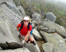
I started off with this idea that I wanted to hike the entire trail, albeit in sections, contiguously from South to North. However, the trail starts with one of the most remote sections, Big Cypress National Preserve. I had read in the Florida Trail literature, and other trip journals that the lower swamp sections are strenuous, and should not be attempted alone. The water level in the swamp is currently quite high from Hurricane Wilma’s passage over south Florida late last fall. As luck would have it, I stumbled across a group that annually hikes the Loop Rd to Oasis Visitor Center segment. I contacted them and they agreed to let me join them. At the last minute, Mindi, a recent acquaintance from an online Women's hiking group decided to join me too. We drove down to the meeting point at the Oasis Visitor center in the middle of the night. The highlight of our drive was on SR 29, shortly after exiting Interstate 75. Passing through the Florida Panther refuge area, we saw a panther on the side of the highway. An exciting first for both of us. It would have been nice if I had had the presence of mind to stop or double back to attempt a photo!
 We arrived at Oasis visitor center at around 5:30am and settled down for a power nap. I managed an hour or so of sleep before birdsong and the sounds of the occupant of a nearby vehicle woke me. We boiled some water for coffee and oatmeal breakfast, then stopped by the gator pond to enjoy our morning coffee before the group assembled at 8:30ish.
At 9am we stopped by the visitor center, arranged for the permit, checked with the Ranger for current trail conditions, and watched the 15 minute video about the ecology of the Preserve. The Ranger advised that the trail was rough, and mostly under mud and likely knee high water. He warned about the large numbers of Cottonmouth snakes, but thought we should get through OK. We shuttled in one van about 13 miles by road to the trailhead where we were joined by the remainder of the group. We saw 3 gators and a deer on the lime road, the only wildlife we saw all day. In all there were eleven in the hiking group, Mindi and myself being the only women.
It was around 10:30 when we set off on the trail. The weather was great for hiking, warm enough to be comfortable with a minimum of clothes, but not hot, and with a gentle breeze. The cypress trees have no foliage at this time of year, and the bromeliads and other plants have just started to flower. The predominant colors are silver grey, with a lightly overcast blue sky. The trail for most of its length is potholed limestone base covered by varying depths of dark, slippery mud and puddles.
Within 20 feet the trail is muddy, and wet, and water was already over the tops of my shoes giving me wet feet. A previous swamp backpack trip 2 weeks ago had left me with large blisters on my left heel and toe. Neither were bothering me now, but I was a little concerned that with the immediate wet that I may be in for a recurrence of either, both, or more.
The three first mile of the hike is through a cypress grove and grassy prairie. There is little shade, and the sky cleared somewhat in the warmest part of the day, but was still pleasant. We saw bobcat and raccoon tracks, a variety of birds, signs of deer remains (presumably some cat's feast), and cypress trees that were obviously "cat scratch" posts, but no other wildlife. We intended to stop for lunch at Frog Hammock Camp (a "hammock" is a slightly elevated and therefore often drier island in the swamp) but it was already occupied when we arrived, so we continued on.
The trail at this 3 - 4 mile section becomes much more swamplike. Elevation changes of only a few feet make swampy pools of slowly moving water among slightly raised areas of brush, vines, ferns, and other undergrowth. There is much more green and brown. A compost like base to the trail means less mud and limestone directly underfoot, but to get to these raised areas the trail passes through the swamp pools. The water here covers the same several inches of mud over limestone, and was mainly around knee high. The water was clear for those lucky enough to traverse first. For those in the rear the slowly swirling mud obscured the potholes, cypress knees, fallen logs, roots, etc. A hiking pole is definitely an advantage here for probing ahead to gauge footing and depth, and for stability when a pothole, root, knee, stump, other unseen hazard, or just plain old mud causes imbalance. On the raised hammocks the water is no longer an issue, but the dense undergrowth means bushwhacking though vines, palmetto scrub, under and over fallen trees, limbs, etc.
This mile or so of trail has been heavily affected by Hurricane Wilma last fall. Many of the trees that have the trail marking orange blazes have fallen. Many more trees are down across the trail, and the undergrowth is thick and thorn covered. We frequently could not see the next orange marker and could not discern which direction the trail continued. At these places several of the front hikers would fan out looking for blazed trees, while the remainder waited back at the last known blaze. When someone discovered the next marker we would all attempt to follow their course, and seek out the next blaze.
It was only a fairly short stretch where this was a concern, but bushwacking hiking like this is tedious and time consuming. We had not yet even had lunch, and for a short period there was some discussion of maybe retracing our steps to return back the way we had come. Eventually though, we stumbled our way from blaze to blaze and somewhere around mile 4 got back to a fairly straight, though submerged trail that could be easily followed. Here, in a slightly raised area with not too much brush we stopped for lunch. There was no real dry ground. Some settled on a log or stump, but most (including me) just stood to eat.
The trail here turned to a channel of knee high water over the mud, limestone potholes, cypress roots and knees. There was little underbrush allowing a faster, though splashier pace. As we set off, someone noticed that we had shared our lunch spot with a snake. I was already several yards down the trail, and did not go back to see it, but those that did said it was a Cottonmouth. It was less than 2 feet from where one of the party had just rested for 20 minutes eating lunch, and not one of us had seen it!
The submerged trail continued as this slosh through muddy water. The mud underfoot was ever present, with the potholes, cypress knees, logs, etc., providing frequent obstacles. One step the water may be only 6 inches deep, the next maybe up to the knees. After about 1/2 mile the land elevated slightly and the terrain turned back to the cypress prairie that we had encountered for the first several miles. Most of the deep water disappeared, but the mud here was deeper than the start of the hike. Maybe it was just perception as now my legs were getting tired, and my shoes were now filled with and encased in several pounds of mud, but the mud seemed slippier too. The deepest, slippiest sections caused a vacuum to be created within my shoes at each step. This meant curling my toes to release the inner shoe vacuum. My feet were already kind of busy trying to move forward, stay gripped on the trail, lift pounds of slimy mud, avoid potholes, and attempt to keep my legs and body in a vertical position. Now I was asking them to curl up to de-suction too. They weren't very happy with me! Once again I was grateful for the hiking pole, which prevented me falling several times.
 During this muddy mile, while concentrating almost exclusively on where feet were being placed we came across two more Cottonmouths lying right next to the trail. Seeing three in such a short distance made me wonder how many we hadn't seen!
The final mile or so of trail was less prairie and more Cypress trees. The trail was still as muddy, and the trudging through it slow. Finally, at the 7 mile mark the road and Oasis visitor center are visible through the leafless cypress trees. Just another 1/4 mile, and a couple of large mud holes (which were mercifully mainly dry) we were back on dry pavement at Oasis. The visitor center has an outdoor faucet, which was put to use de-mudding and shoe washing, and bathrooms, where I washed and combed up and tried to look human again. As hard as the hike had seemed on my feet they were totally blister free, and actually didn't feel at all bad once happy again in clean dry socks. I have decided to attribute my problems two weeks ago to wearing a different brand of sock, which must have compressed too much when wet and allowed my left foot to slide within the shoe. I'll stick to my wool socks and synthetic liner in future. We headed for home, stopping for a "greasy McBurger" on the way home. We had definitely worked off any additional calories and fat it might cause.
View more photos in my Picasa album