
The Cross Florida Greenway has an interesting history. There was once a plan (1820s) to prevent sailing ships from having to sail around Florida to the south, by building a cross Florida Shipway. To achieve this, the St Johns, Oklawaha, and Withlacoochee rivers would be linked with an artificial saltwater waterway. Seawater would flow from the Atlantic to the Gulf. Most of Florida would become an island. Fortunately, the potential sea ports were not deep enough to justify investment in this project and it died.
In the 1930's the plan was resurrected as the Cross Florida Barge Canal. This time, a series of locks and dams was proposed to basically achieve the same aim: create a continuous waterway across the state. This time, there was also a need to create jobs, so the plan was initially funded and work started. Money soon ran out, and the project was once again shelved until the 1960s, when once again someone imagined it would be a good idea, and work recommenced, clearing huge tracts of land of their native vegetation, flooding river valleys, and digging huge pits which would eventually be flooded to form canals. Fortunately, this time, when the money ran short and environmentalists stepped in, the decision was to permanently scrap this idea and to turn the corridor of potential and actual desecration into a conservation and recreation area. The Cross Florida Greenway is that area. It is a linear park 110 miles long. The Florida Trail runs through the Greenway for part of the western connector leading up to Ocala Natioanl Forest. The terrain in this section is varied, from cleared fields, massive diggings, and soil midden piles, overlaid on a gently rolling natural landscape.
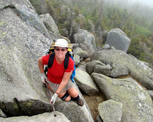
 The structure in the photo on the left is one of the bridge pilings that was built to take US441 across the canal. The canal was not completed, and neither was the bridge. US441 currently runs quite contentedly across the solid ground it was built on. Apart from this artifact, there is little evidence of the intended canal plan along this portion of the trail. Instead is a wonderful protected corridor of shaded oak trails and open areas of new young pines.
 One of the unique features of the Greenway is the Land Bridge. This is a bridge over Interstate 75 that was built specifically for the greenway for the sole purpose of enabling wildlife and recreation to safely cross the highway. It has no roads leading to it, and it was not originally built as a road and converted to a trail. It was purpose built, and even includes native plantings and a window in each direction (with safety bars, of course) to allow viewing of the poor folks down below driving while us lucky hikers and bikers are enjoying a day on the trail.
A small complication this weekend is the weather. What a difference a week makes. Last week, in this area it was hot and very sweaty with nightime temps in the high 50's and daytime of high 80s. This weekend ranged from below 40 degree mornings, and hardly made it above 60 during the day, add a brisk and cold wind and it was downright chilly.
This weekend, I'm self shuttling with my bicycle, which can be challenging. First off, I don't do it with a full backpack, so it's only really feasible for dayhikes, or from somewhere where I can leave the backpack securely while I bike and hike. I try to avoid busy highways, as drivers just don't give bicycles enough room. Finally, there is something much more comforting about having the car at the end of a hike rather than seeing a bicycle and knowing I have to bike back to my start point, so I generally leave the car at my destination trailhead, bike to the starting trailhead, hike back to the car, and then return to the start for the bicycle. It seems like a lot of work to hike, but I can generally cover the miles 4 times faster on the bike, saving time on a linear hike that I would have spent backtracking to the car. So I get to hike a little further in the same amount of time, provided there are reasonable road routes between trailheads.
On the Pruitt to 49th street portion the trail skirts along the deep pits that were intended to become the canal, and up onto the banks, and what I assumed were the dirt piles that were dug from the pits. There are "hills" and switchbacks on the trail, and rocks. You don't get to see many of those for most of the Florida trail.
I passed through one area that was very recentlky burnt, with a few logs still smoldering, but for the most part the trail was fresh with spring green. This created a nice varied trail, ups and downs, lots of spring flowers, mainly shady forest, and a few beautiful areas of young oak trees, and young pines. A thoroughly enjoyable hike, though I would not have complained if it had been 10 degrees warmer!
View more photos in my Picasa album
No comments:
Post a Comment